1. Planning
Analysis of existing statutory records (stat plans) and definition of the survey area for optimal site clearance.

Make the invisible visible. Mitigate construction risks and increase productivity with non-destructive Subsurface Utility Engineering (SUE). Before the excavators arrive, we deliver precise results of underground pipes, cables, anomalies and other features.
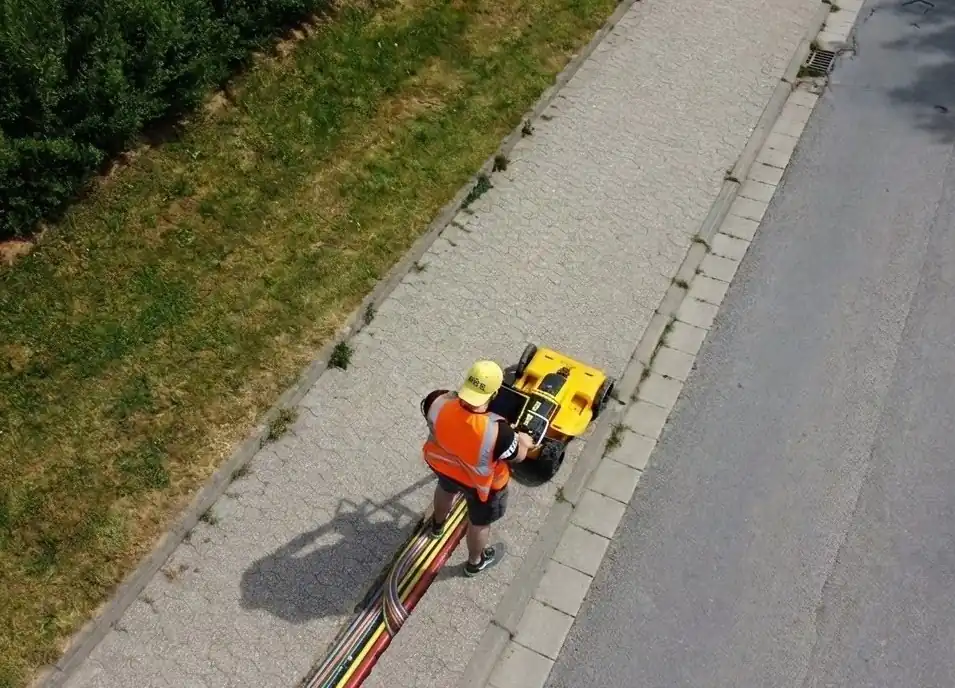
Why rely on outdated as-built drawings when you can map reality?
Inaccurate statutory utility records are the leading cause of expensive cable strikes and project delays, hence riks for life and limb, commercially and lower productivity. Using Ground Penetrating Radar (GPR), we provide a highly accurate, non-destructive method for scanning the subsurface.
Unlike traditional metal detectors, GPR transmits electromagnetic pulses into the ground and records the reflections. The result? A complete profile of the underground environment.
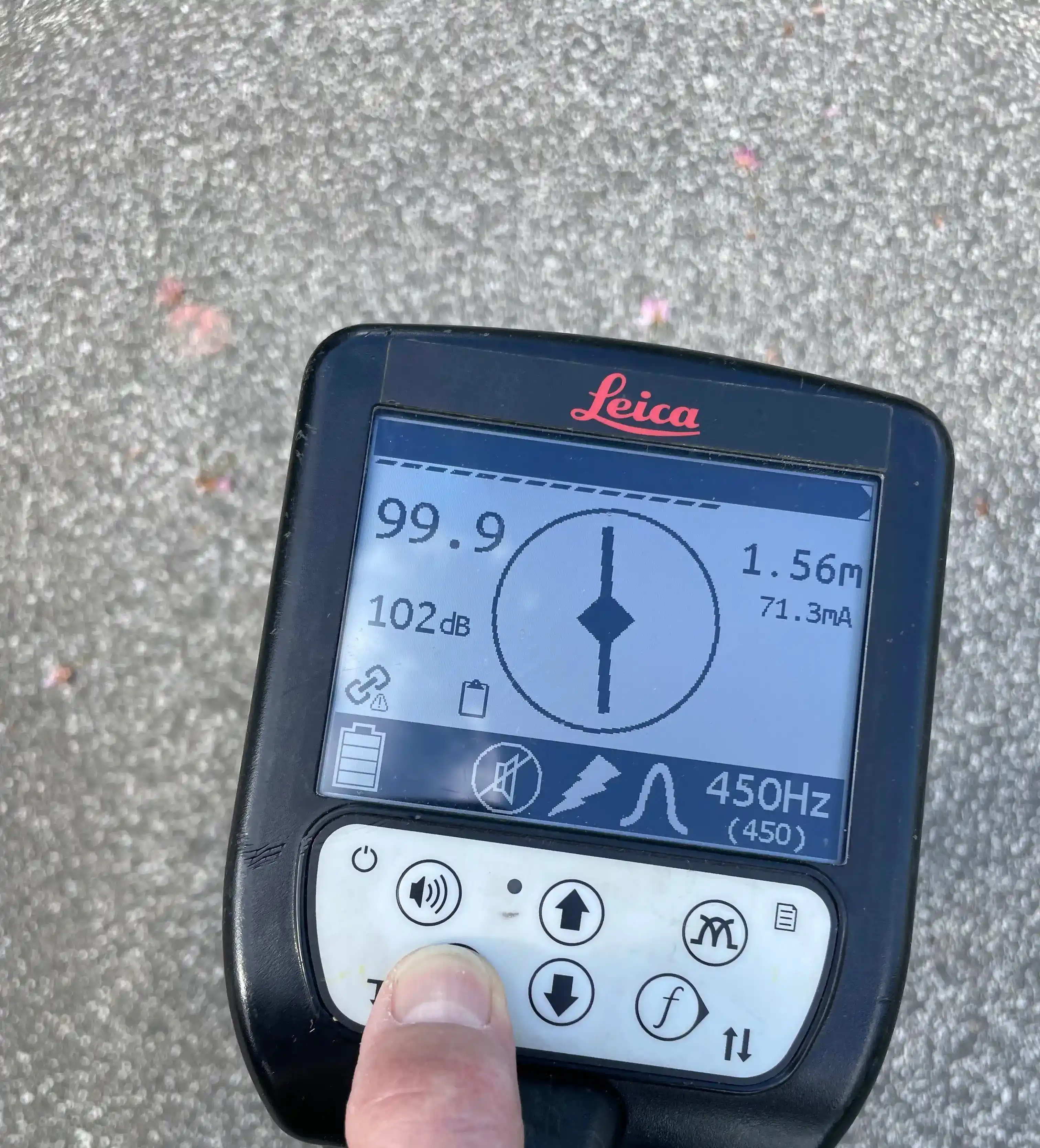
100% confidence through redundant surveying methods.
A professional subsurface utility survey never relies on a single technology. To validate our GPR data and positively identify active utility networks, we combine our scans with Electromagnetic Locators (EML).
These devices are specifically designed to detect the electromagnetic fields emitted by live cables or induced into metallic pipes, guaranteeing comprehensive site clearance before you dig.
We take full responsibility for data collection. No stress for you—just actionable, high-precision deliverables mapped directly into your GIS or CAD system.
Analysis of existing statutory records (stat plans) and definition of the survey area for optimal site clearance.
Deployment of high-end GPR systems and EML locators on-site. Georeferencing of all findings via RTK-GNSS (GPS) with cm-level accuracy.
Advanced filtering of radargrams by our geophysical experts to extract even the weakest signals (e.g., deep clay pipes).
Delivery of the final utility mapping as 2D/3D CAD (.dwg), Shapefiles, or BIM models—ready to integrate into your workflow.
A brief look into our data interpretation for detecting underground utilities using Ground Penetrating Radar
The process begins in the post-processing editor, where we review the radar data over the mapped survey area. We look for distinct indicators, such as continuous lines showing strong signal intensity at specific depths.
For example, during the analysis, the first entity that often stands out is a prominent line of high intensity, which we trace along its entire path to determine its alignment.
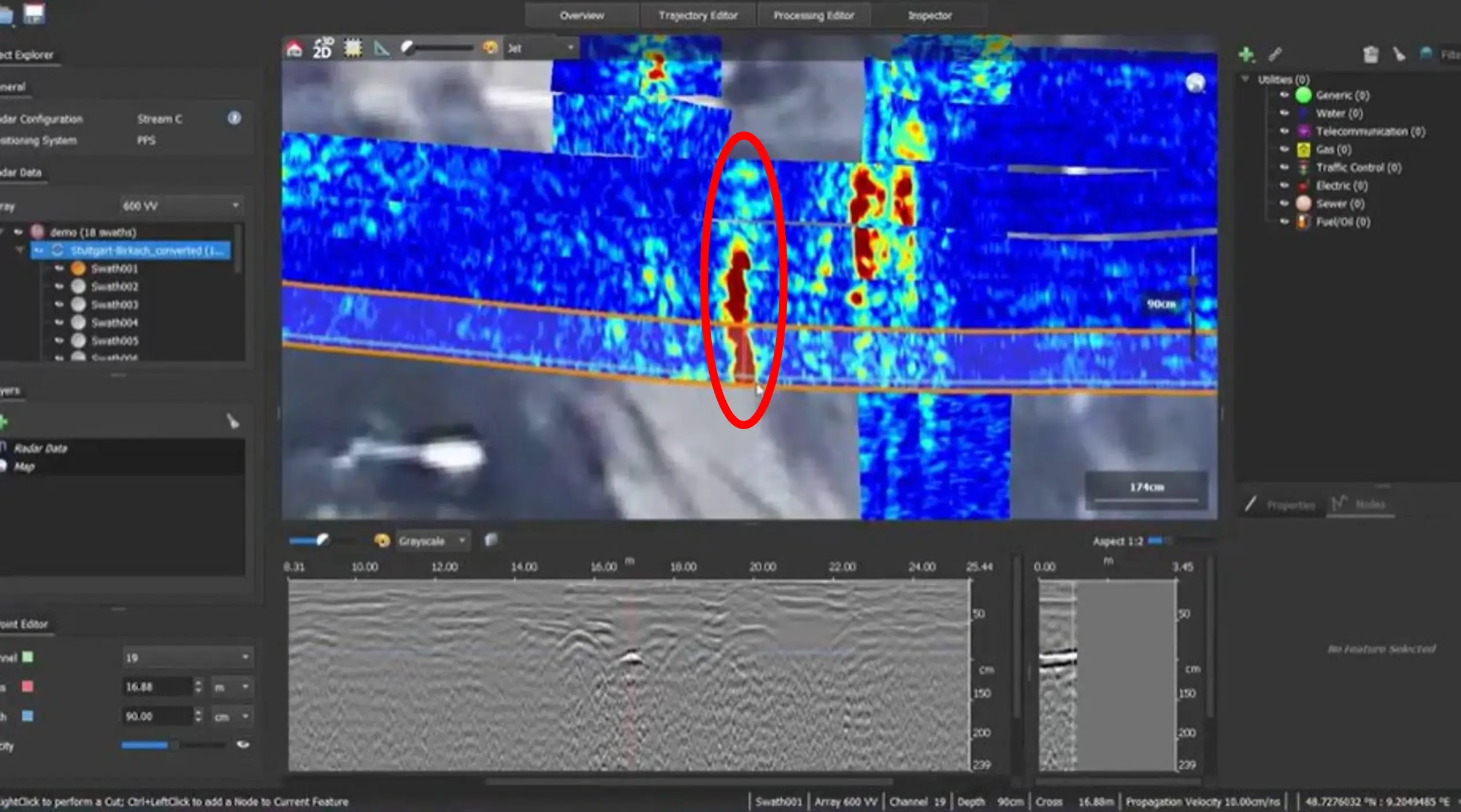
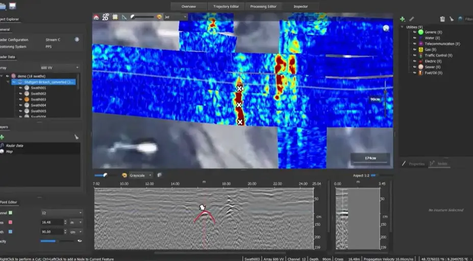
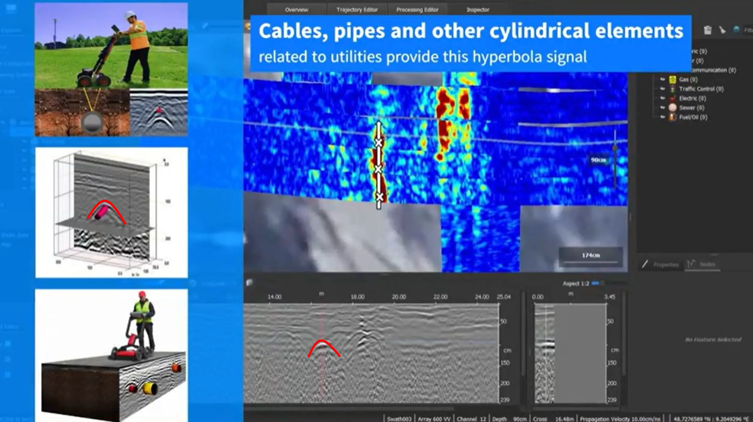
To confirm what lies beneath, we analyze the data at different points across cross-sections. When the electromagnetic signal transmitted by the device intersects a cylindrical or curved subsurface entity, it creates a distinct formation known as a hyperbola.
Looking at the radargram profile, the presence of these hyperbolic curves is a solid sign of a buried utility elements.
Every time a hyperbola is identified, it is pinpointed and classified within the software's interface. It is often enough to analyze only a few points to get a clear idea of the structure.
That being said, we mark the series of detected hyperbolas along the continuous line as a confirmed utility line. Repeating this core idea, we go through the entire data set to analyze it and map the complete network. Why hyperbola is important? Because cables, pipes, and many other things related to utilities have these cylindrical shapes.
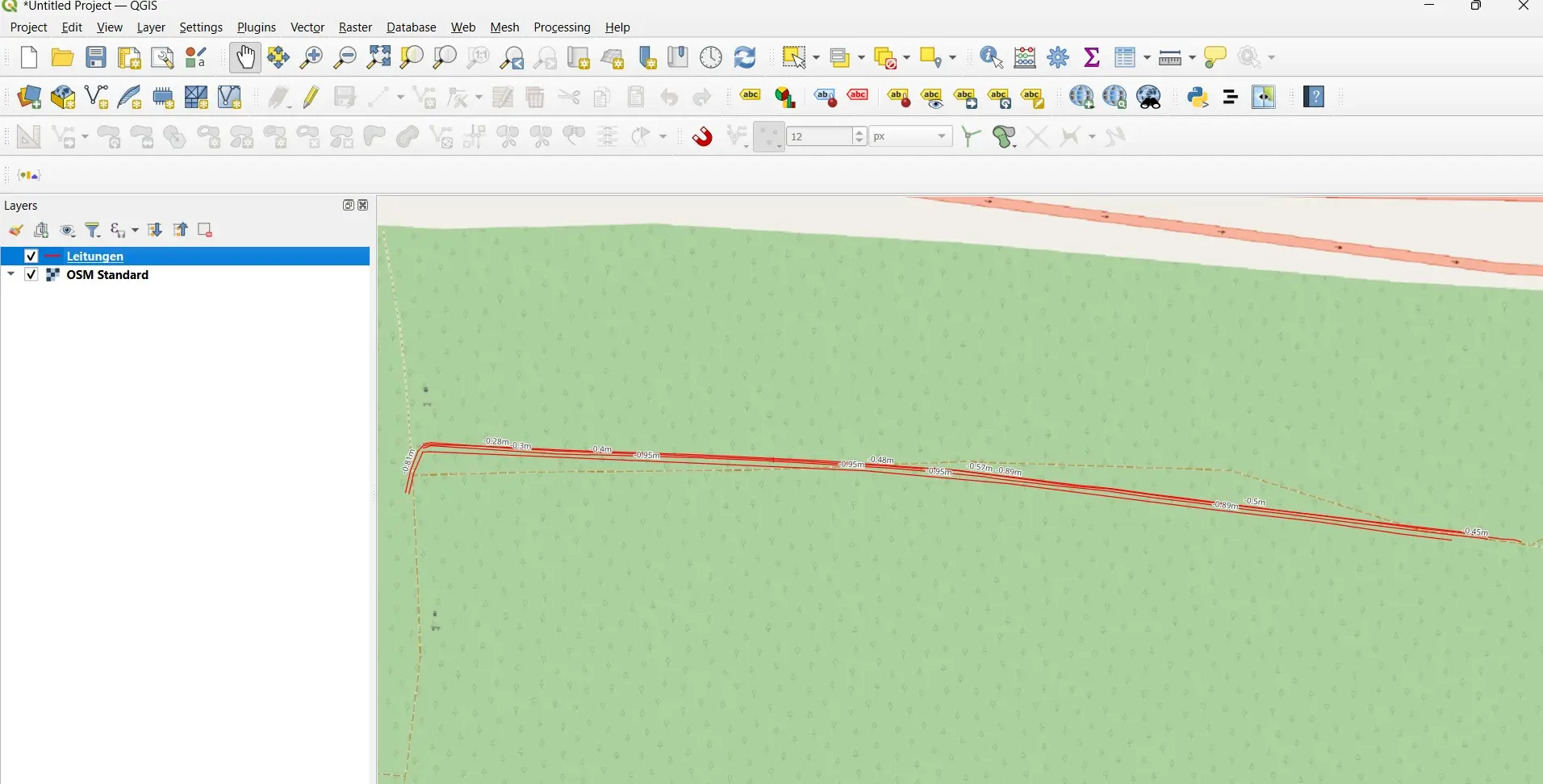
Finally, we export the results of the radar analysis into a GIS (Geographic Information System) work environment.
This final step is necessary to make the last changes, format the attributes, and create the accurate cartographic product that will be delivered to your engineering and construction teams.
Transparent answers to the most common technical questions from civil engineers and project developers.
Our equipment allows us to penetrate up to 6m deep in the soil. Quality of signal for penetration depth depends heavily on soil conditions and the antenna frequency used. In dry, sandy soils, we can reach the best signal. In wet, heavy clay soils radar signal si attenuated, but strong enough to clearly detect many of the underground utilities without big challenges. We always select the optimal antenna (e.g., 400 MHz or 600 MHz) for your specific site conditions.
Yes. Because fiber optics and plastics (PE/PVC) are non-magnetic, classic cable locators fail completely. However, GPR reacts to changes in material density (dielectric constant). This allows us to precisely locate empty conduits, fiber optic trenches, and plastic water mains.
Utility network plans are often outdated, incomplete, or referenced to landmarks (like curbs) that have shifted over the years. Furthermore, private service connections or abandoned lines are rarely documented. An on-site geophysical utility survey is the only way to reduce the risk of utility strikes to near 0%.