Portfolio & Case Studies

Just few case studies demonstrating our ability to deliver critical data in challenging environments. Precision, compliance, and safety.

Featured Projects

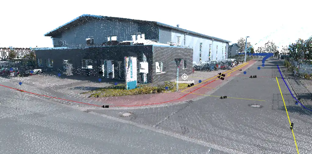
Underground Utilities Mapped in a 3D Scene using GPR & Mobile Mapping

Complete Digital Scene With Underground And Surface Assets

Context: The customer needed an overview of the assets on his work platform, both underground and above ground, but one that would allow him to virtually manipulate them for various simulations and make data-based decisions just a click away.

Intervention: We deployed our 3D mapping capabilities through Mobile Mapping using LiDAR technology and 360 panoramas to capture and process surface objects. And for underground objects we applied Ground Penetrating Radar (GPR) data collection and analysis.

Result: The deliverable consisted of a 3D scene that was complex in terms of data, but easy to visualize and manipulate for the end user.

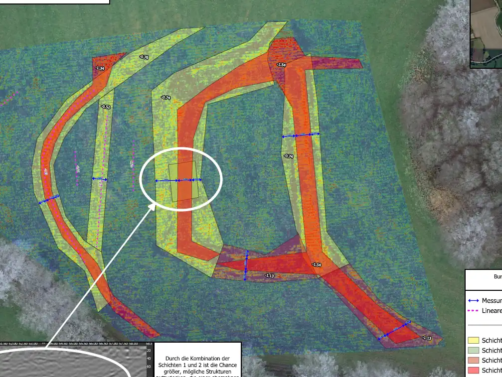
Final map of an archaeological project using gpr

The Archaeological Structures of a Settlement

Context: The client had incomplete information about the presence of a structure associated with human settlements hundreds of years old and needed factual confirmation of its presence.

Intervention: Our team used GPR scans to analyze the contrast of the target environment in order to isolate the elements relevant to the search. At the same time, historical and field data were aggregated and placed all in a geospatial environment.

Result: The final product consisted of a geospatial data set ready for use both in the field and in the office, but also a detailed map with the precise location both vertically and horizontally of the underground structures that later confirmed the search hypothesis.

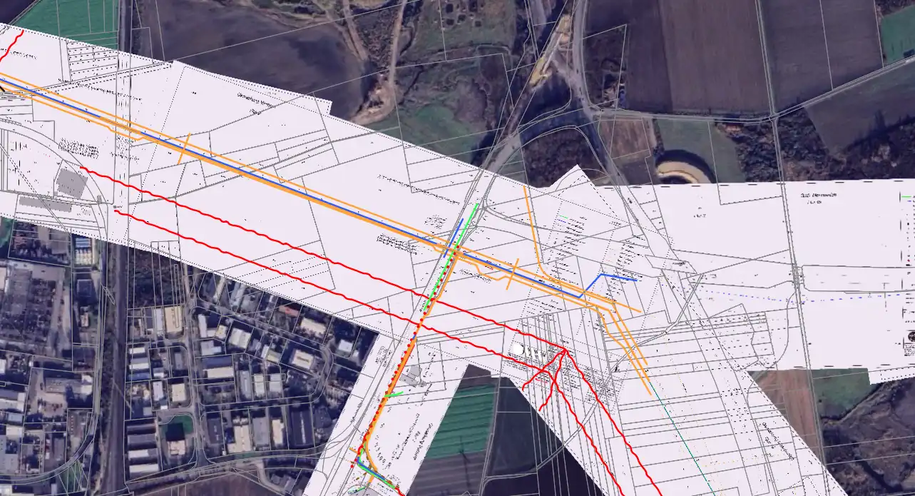
Results of digitized utility network plans using GIS

Large-Scale Digitalization of Utility Networks

Context: Our customer had a database of plans containing information about the placement of existing and future utility networks. However, their database consisted of only simple images, without any spatial attributes or manageable spatial elements such as vectors.

Intervention: We took each plan individually and through a manual process combined with automated operations, we managed to give each plan the spatial information it needed and build all the utility networks in vector format and topologically correct, while also assigning them relevant metadata.

Result: The data sent is completed from A to Z and ready to use regardless of the working environment, being open to any post-processing and editing at the client's discretion.